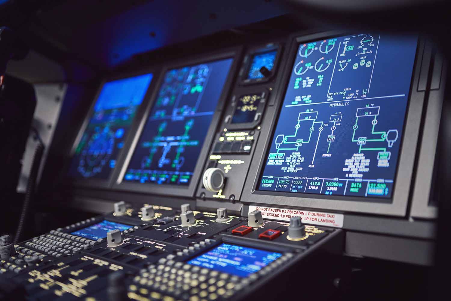
AXIS provides avionics simulation software for essential systems found in today’s aircraft. Each module reflects the real behavior and logic of the actual equipment, offering pilots and trainees the chance to safely practice critical procedures, understand system limitations, and build operational confidence. Avionic simulations can be used stand-alone or integrated into full-flight devices as part of the aircraft simulator software, and tailored to match specific aircraft types.
TAWS SIMULATION
AXIS TAWS Terrain Avoidance Warning System Simulation
AXIS TAWS Simulation/EGPWS Flight Simulator uses the same worldwide elevation data and airplane instrument values as in real life to predict whether the calculated future position of the aircraft will intersect with the ground.
The trainee gets aural and visual warning of impending terrain, ensuring a comprehensive understanding of the function of such a system and helping develop the ability to anticipate, for safe operation in real life.
- Forward-Looking Terrain Avoidance (FLTA)
- GPS Integration
- Database of terrain and obstacles
- Aural and visual alerts
TCAS II SIMULATION
The AXIS TCAS II 7.1 Traffic Alert and Collision Avoidance System
AXIS stays at the forefront of avionics technology, and our advanced Traffic Alert Simulation is frequently updated to reflect the latest standards. Currently TCAS II Version 7.1 is the worldwide standard.
TCAS II (Traffic Alert and Collision Avoidance System) is the widely known implementation of the ACAS II standard (Airborne collision Avoidance System). It generates two types of alerts for pilots: Traffic Advisories (TAs) and Resolution Advisories (RAs).
Our TCAS II Simulation accurately displays and explains the procedures and functions of all TCAS II Version 7.1. Traffic and Resolution Advisories.
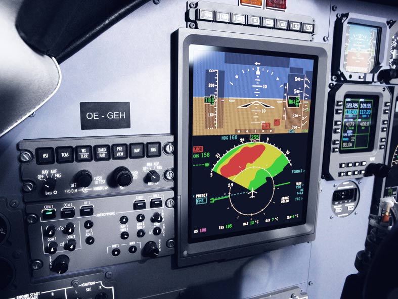
WXR SIMULATION
Bad weather can’t be controlled, so a detailed weather briefing is a must before every flight. As weather extremes become more frequent, accurate weather detection and avoidance systems are critical to ensure safety in aviation.
AXIS’ innovative AX-WXR weather radar simulation not only simulates the specific hardware of various aircraft, but also provides realistic WXR simulation of conditions such as cumulonimbus (CB) clouds combined with icing, heavy precipitation, thunder and high turbulence, so pilots can choose flight paths early enough to avoid disruptions to the flight, significantly reducing flight deck workload.
AX-WXR also helps trainees understand the shortfalls of such systems in real life, like attenuation, occluded weather, and using the wrong tilt, so they can develop strategies in a safe environment should the system ever fail.
The AX-WXR weather radar simulation system has been tested and implemented successfully in many different simulators all over the world.
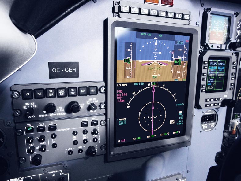
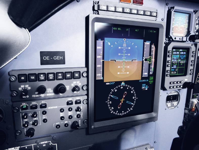
GPS/LPV SIMULATION
Localizer Performance with Vertical Guidance (LPV) is a subsection of Area Navigation (RNAV) approaches (commonly also known as GPS approaches) and an improvement over the more common RNAV approach modes LNAV/VNAV.
Approaches to LPV minima are non-precision, but are very similar to precision approaches (ILS). The difference is that ILS is a ground-based approach, which needs transmitters and antennas for each individual runway and provides straight-in guidance.
RNAV LPV guidance uses the space-based Global Navigation Satellite System (GNSS), which can provide flexible horizontal and vertical guidance to an unlimited number of aircraft simultaneously conducting different approaches, and is independent of ground equipment.
AXIS LPV/GPS Simulation replicates the same systems as found in real aircraft, helping trainees understand their safe operation and also experience the shortfalls of such systems in a safe environment.
ADDITIONAL INFORMATION
-
Are there differences betweeen GPWS/EGPWS/TAWS?
- GPWS (Ground Proximity Warning System):
This is the basic system that provides alerts of proximity to the ground, including alerts for excessive sink rate, terrain closure rate, descent after takeoff, and unsafe terrain proximity based on the radio altimeter input.
- EGPWS (Enhanced Ground Proximity Warning System):
Enhances GPWS with a global terrain database, GPS positioning, and predictive algorithms.
- TAWS (Terrain Awareness and Warning System):
The common term for the aforementioned systems, incorporating all the advantages as a moving colored map overlay.
-
How does a TCAS II work?
- TCAS II data is acquired through interrogation of the on-board transponders of proximate traffic in the airspace. Advisory logic issues alerts of potential threats based on the time of closest approach and projected miss distance. This relies on a fixed set of rules replicating the most common pilot responses.
- TAs warn pilots of nearby traffic, giving the crew time to visually acquire the other aircraft and prepare for potential avoidance maneuvers.
- RAs provide specific vertical speed instructions to avoid a collision.
- Examples:
“Climb, climb!”: Advice to climb immediately to avoid conflicting traffic.
“Maintain Vertical Speed, Maintain”: Advice to maintain current vertical speed, staying within the green zone of the VSI.